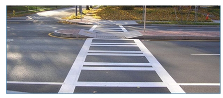
Signal timing
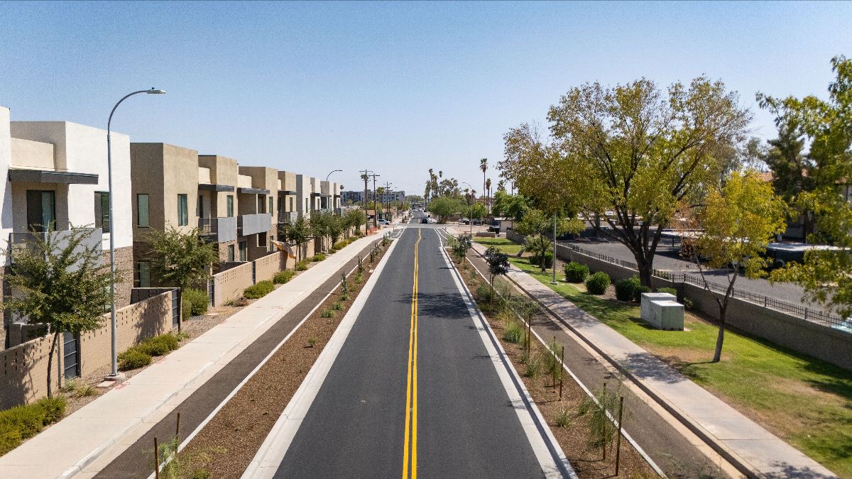
Signal optimization helps communities make better use of existing infrastructure while improving daily travel for residents and visitors.
 Skip to main content
Building on community input, transportation needs, and City priorities, these Recommendations identify projects and investments to create a safer, more connected, accessible, and sustainable transportation system for everyone in Tempe.
Today over 2 million trips are taken every weekday in Tempe, the majority of which (81%) are taken by car. By 2050, the total number of daily trips is expected to increase to 2.7, an increase of 35%.
This 35% increase in trips assumes the percentage of people who drive alone, carpool, bike or walk for these trips will not change. However, Tempe is investing in improvements to the transportation system that makes alternative modes more convenient, safer, and more efficient. If Tempe were to increase all alternate mode trips by just 20%, the City may reduce this increase in single-occupancy vehicle trips by half by 2050. By providing more travel options, travelers will have better choices enabling the City to manage this increase in demand.
Source: HDR analysis of Maricopa Association of Governments travel forecasts, 2026Consistent with the Tempe General Plan 2050, the Tempe Transportation Plan 2050 will create a connected, multimodal transportation system that enhances quality of life, strengthens community connections, expands mobility choices, and supports a sustainable future for all who live, work, learn, and visit in Tempe.
The following principles serve as the foundation for this project. They guide planning, design, and implementation of projects, helping the City create solutions that are safe, equitable, resilient, sustainable, and responsive to the needs of current and future users.
Foster a connected and inclusive community by providing transportation choices that strengthen neighborhood connections, expand access to destinations, and reflect the values and needs of Tempe’s diverse residents, businesses, students, and visitors.
Ensure that transportation investments are planned and distributed fairly, reducing barriers to mobility and expanding access to opportunities for all residents, particularly historically underserved and transportation-disadvantaged communities.
Provide a seamless, multimodal transportation system that enables people of all ages and abilities to safely, conveniently, and affordably access opportunities, services, and destinations throughout Tempe.
Invest in and responsibly manage transportation assets to provide a safe, reliable, resilient, and fiscally sustainable system that delivers long-term value to the Tempe community.
Advance a transportation system where every trip can be made safely by supporting Tempe’s Vision Zero goal of eliminating traffic fatalities and serious injuries for all roadway users.
Create a sustainable and resilient transportation system that supports environmental stewardship, adapts to future challenges, and provides reliable mobility for current and future generations.
Recommendations are grounded in Tempe’s vision and goals, system data, and community-identified needs.
Community members shared feedback through surveys, meetings, online maps and pop-up events during the first two planning phases.
Respondents identified transportation concerns and priorities, with open-ended questions providing space for additional feedback. Respondents could select up to three answers for each question.
Among the reasons to walk/roll more, 67% of respondents selected shade and 33% of respondents selected separation between vehicles/pedestrians.Survey summary for Understanding and Gaps and Needs phases now live.
Tempe is committed to eliminating traffic fatalities and serious injuries and ensuring everyone who uses the city’s streets gets home safely.
Crash data helps Tempe understand the scale of the challenge and where improvements are most needed.
from July 1, 2020, through June 30, 2025
Approved in 2019, Tempe’s Vision Zero Action Plan established a citywide commitment to ending fatal and serious injury crashes through safe, equitable mobility.
The Safety Action Plan turns Tempe’s Vision Zero commitment into coordinated, systemic action.
Calls for a safe and secure community through a commitment to public safety and justice.
Resolution No. R2018.13 committed Tempe to eliminating traffic fatalities and serious injuries.
Achieving zero traffic fatalities and serious injuries requires a proactive, systemwide approach to safety. The Safe System Approach recognizes that people make mistakes and focuses on creating safer roads, speeds, vehicles, behaviors, and post-crash care to prevent those mistakes from resulting in severe outcomes.
Click each Approach to see more.
Education, enforcement, and behavior interventions to reduce risky actions.
Implement targeted nighttime enforcement to dissuade midblock pedestrian crossings and speeding in high crash areas.
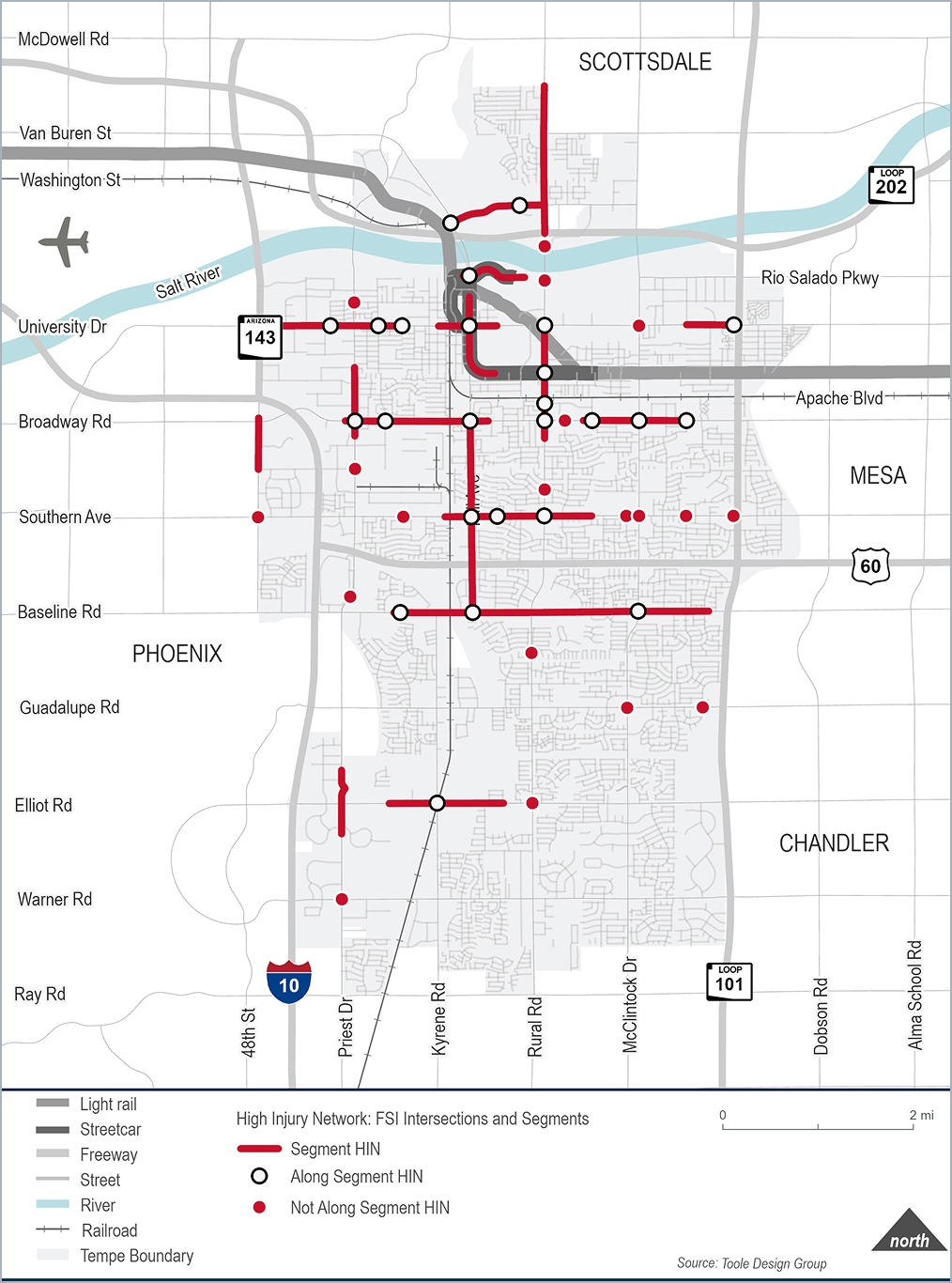
A High Injury Network (HIN) is a map of corridors that identifies streets and intersections with higher rates of Fatal and Serious Injury (FSI) crashes, which result in fatalities or serious injuries.

50.2% FSI Crashes

3.9% of all roads
56.8% FSI Crashes
1.5% of all roads
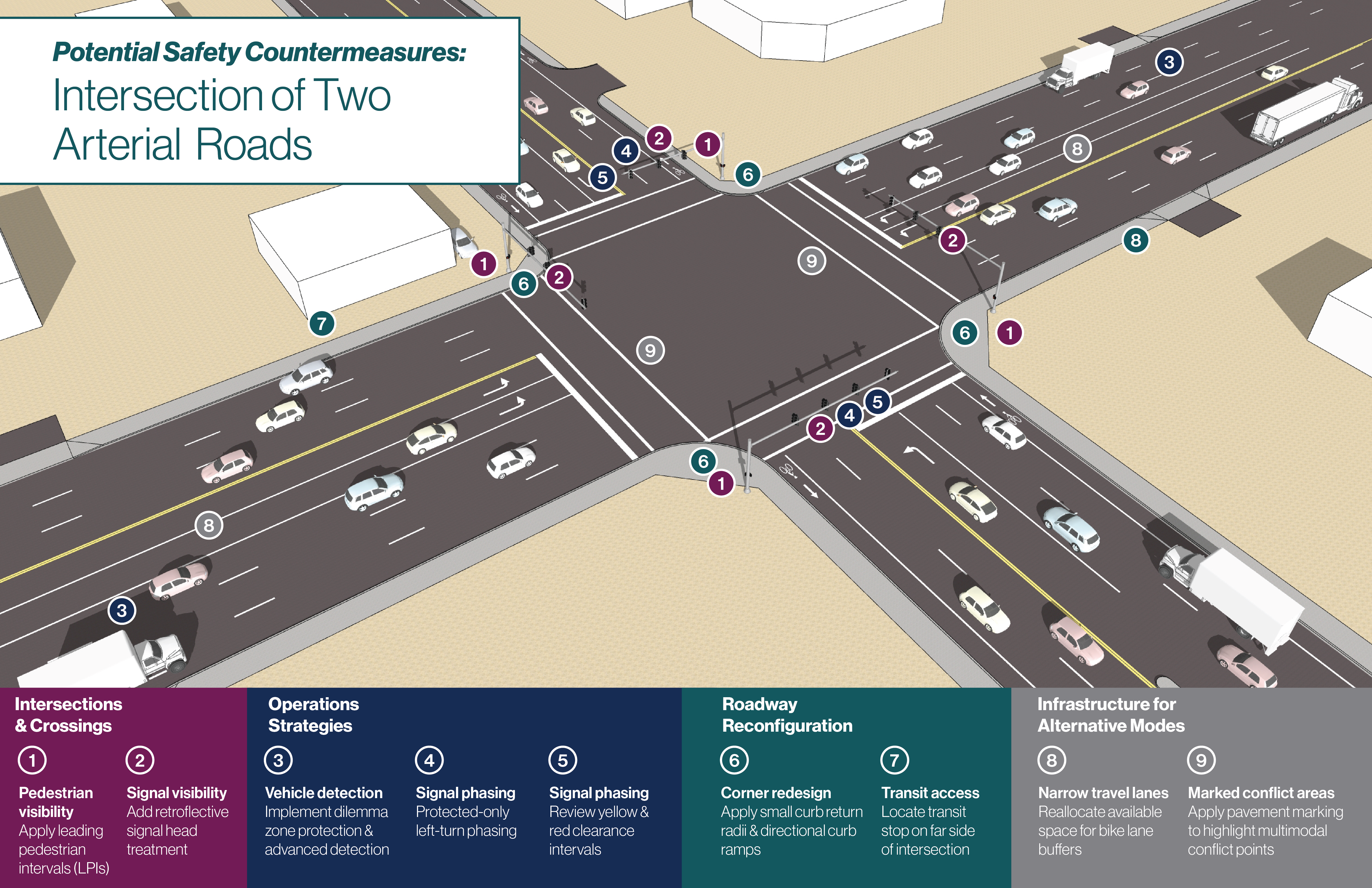
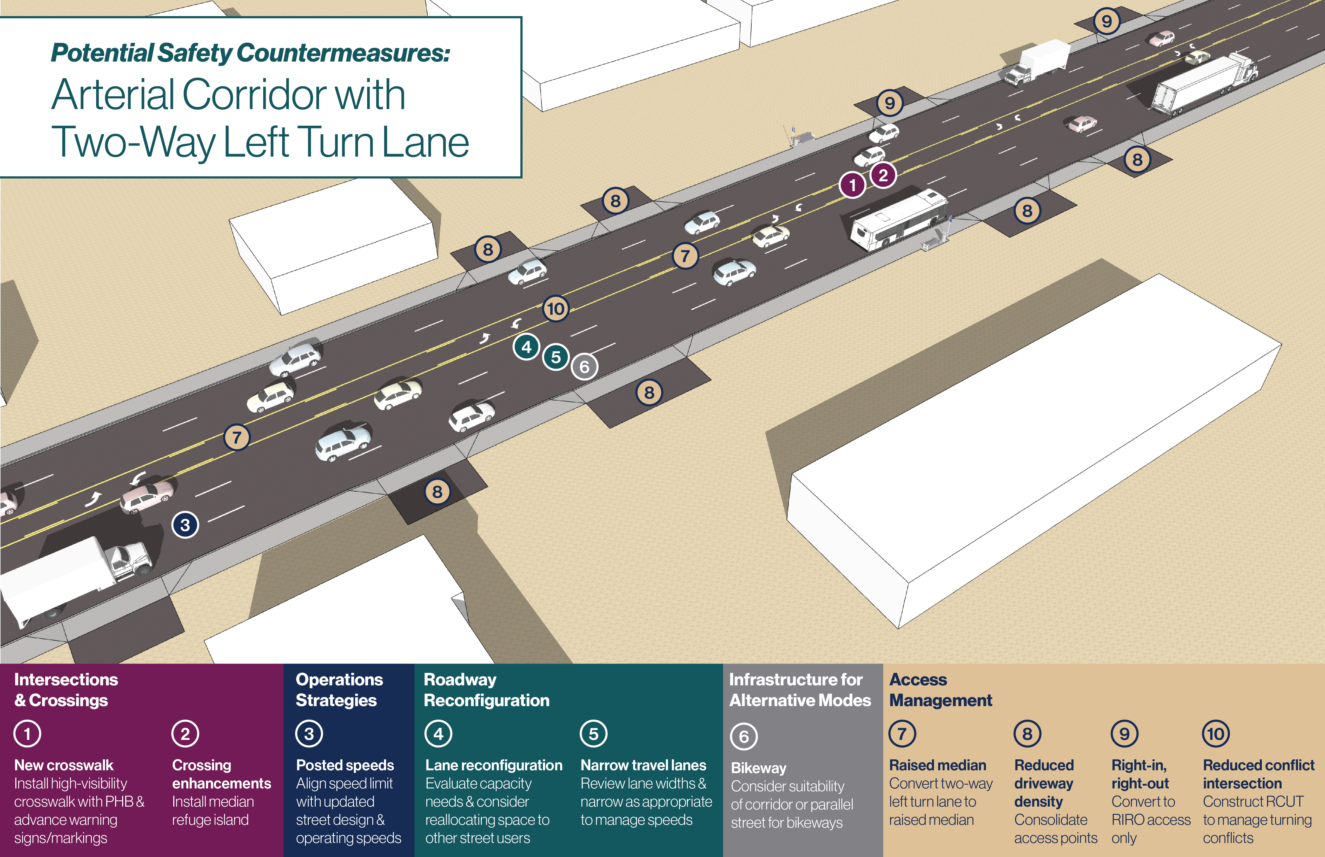
Roadway safety is a citywide priority that requires the application of both location-specific countermeasures and systemwide strategies.
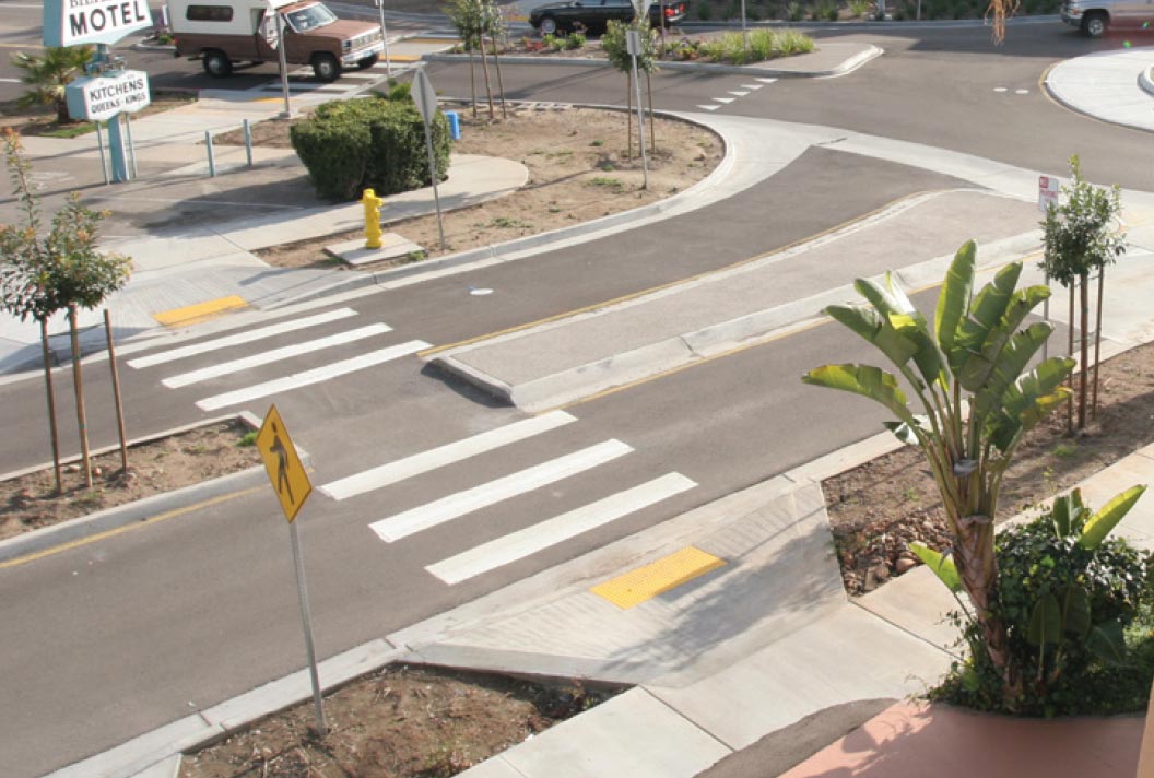
These four graphics present two intersections and two corridor segments with design characteristics that are typical of conditions across the City’s roadway network. They demonstrate how safety countermeasures can be applied in typical locations across Tempe, including both HIN locations and in other parts of Tempe that may not have experienced severe crashes recently but share similar risk factors.
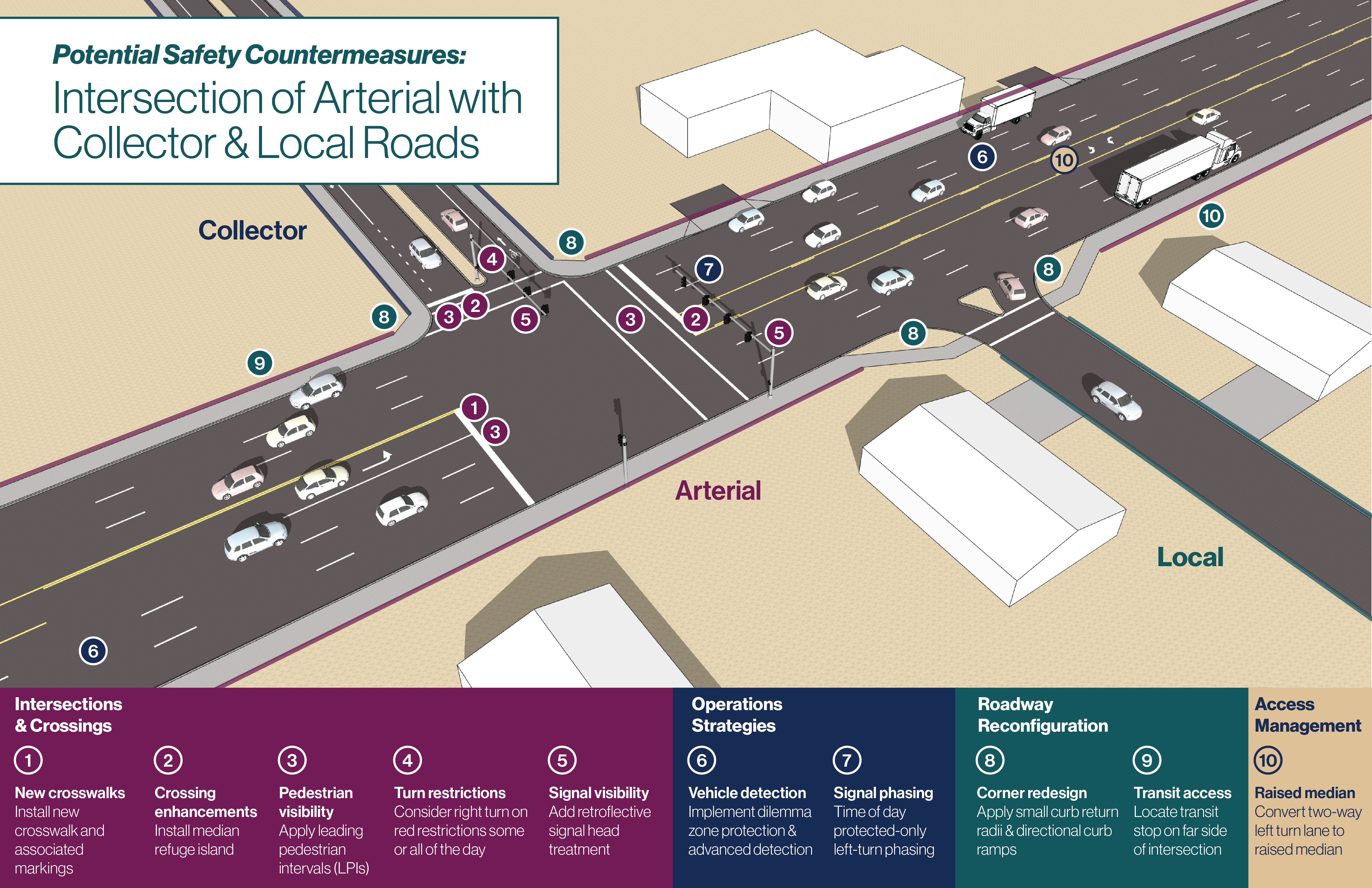
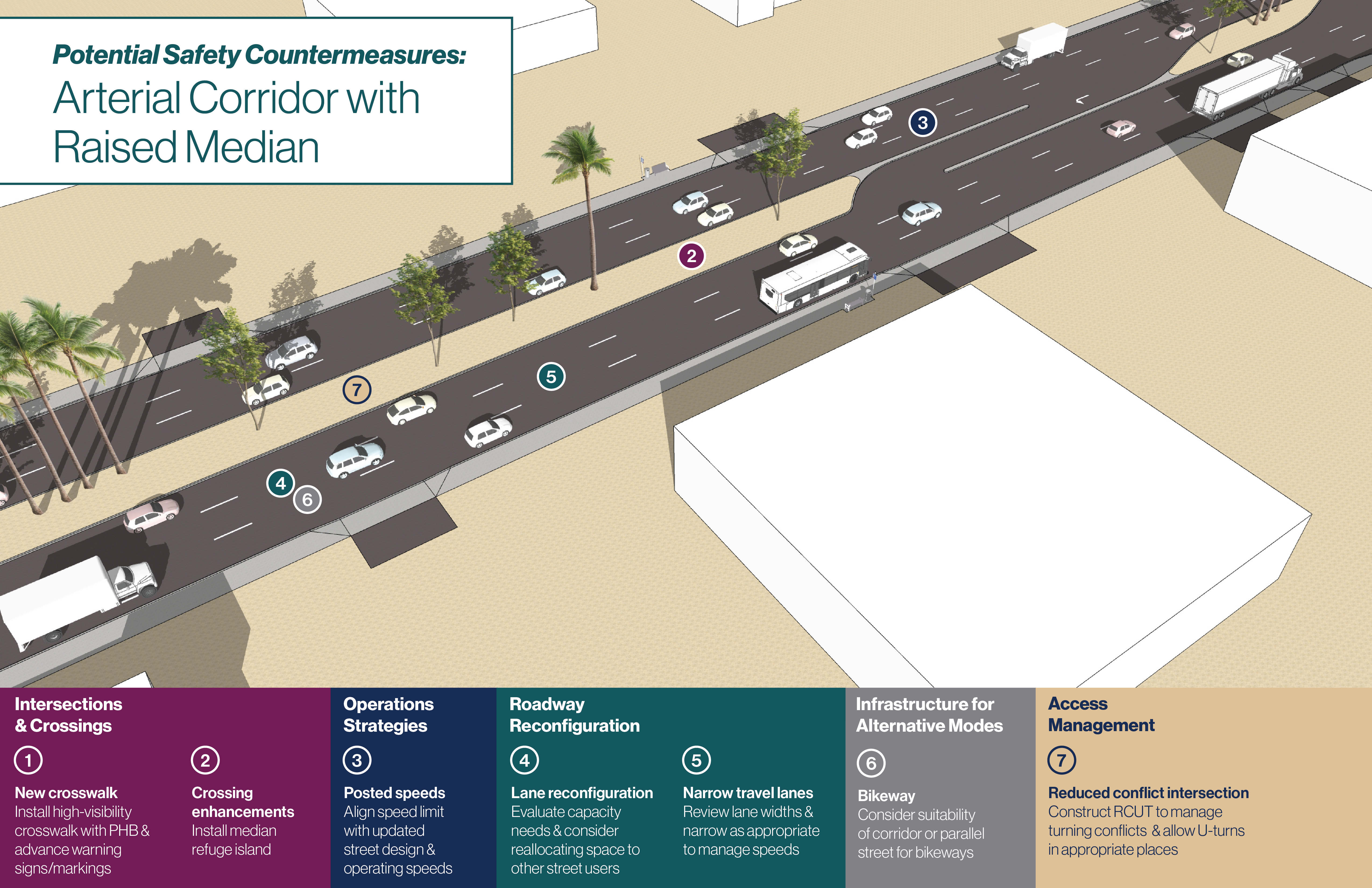
Tempe experiences nearly 1.7 million vehicle trips a day, with 85% of these trips being single occupancy vehicles. Projections for 2050 show the number of daily trips within Tempe increasing 26%.
Tempe’s roadway network currently handles vehicle and truck traffic well, thanks to its grid layout and available road capacity. While congestion still occurs during busy travel times, travel patterns have changed since the COVID-19 pandemic. In the past, traffic typically peaked around the 4:00 p.m. commute; today, peak travel is spread out over a longer period and starts earlier in the day. Seasonal traffic patterns are also changing. Although areas near ASU see about 10% more traffic during the school year (September–May), most of Tempe experiences seasonal traffic fluctuations of less than 10%. (Source: HDR analysis of INRIX traffic data, 2025).
Tempe is not planning to widen roads or add significant roadway capacity. Instead, the City is focused on making the existing street network work better by improving traffic flow, reliability, and safety. As a fully developed community in the heart of the Phoenix region, Tempe must rely on a variety of transportation solutions—not just more space for vehicles—to meet future travel needs.
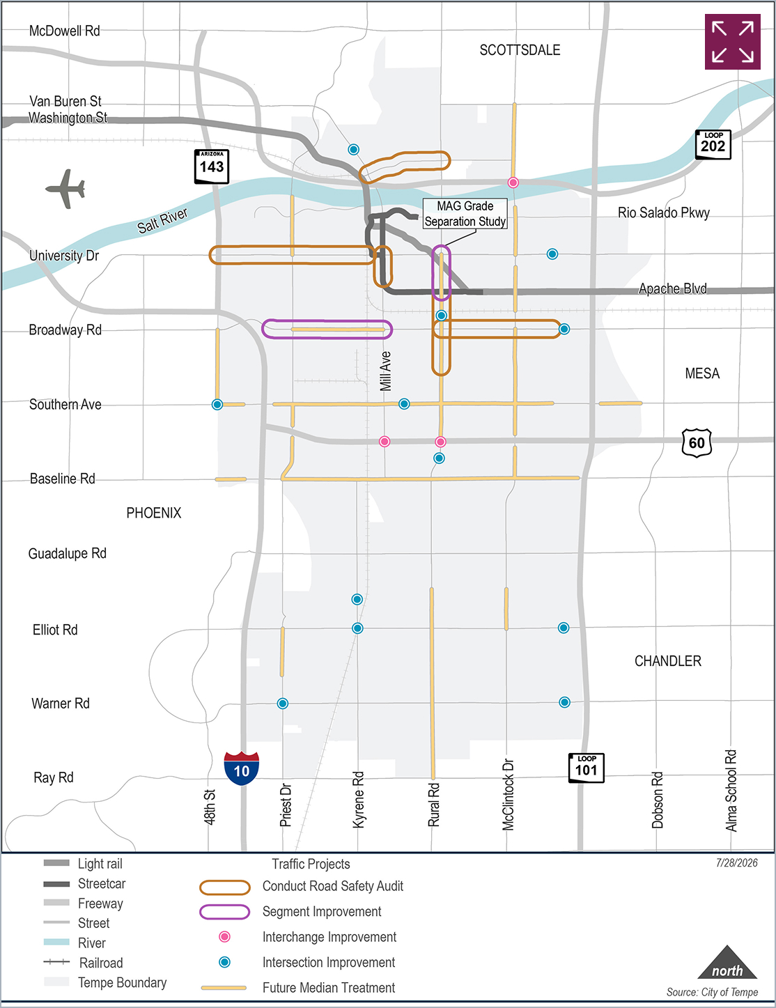
The City's Safety Action Plan identified a network of corridors with higher rates of fatal and serious injury crashes. To improve safety, the Plan recommends continuing and expanding proven safety measures and strategies. The City has also identified several locations for further study and potential improvements, as shown in the figure to the left.

Signal optimization helps communities make better use of existing infrastructure while improving daily travel for residents and visitors.

New technologies help reduce congestion and improve safety by allowing traffic systems to respond more effectively to real-time conditions.

Targeted operational, technology, and infrastructure improvements can reduce congestion, improve safety, and enhance transportation system efficiency.
A principle of Tempe Tomorrow, Tempe’s General Plan is to, “continue to be a leader in multi-modal transportation. No single mode of transportation, by itself, will be sufficient to meet the mobility needs of Tempe.”
Tempe is committed to addressing the safety and comfort needs of the most vulnerable individuals on our streets—people walking, biking, taking transit, and using wheelchairs or other mobility devices—while still balancing the needs of those driving private, commercial, freight, and emergency vehicles.
Mode shift supports transportation equity and affordability by reducing reliance on cars and expanding travel choices, thereby encouraging a shift from single-occupancy vehicle use to alternative modes of travel. Successful mode shift supports City goals around climate, congestion, health, equity, growth management, and Vision Zero.
The City aims to make Tempe’s streets healthier, more vibrant, and more welcoming for everyone. This includes features such as pedestrian-scale lighting, shade trees and landscaping, green stormwater infrastructure, public art, benches, bus shelters, drinking fountains, and other amenities that enhance the street environment. The City also prioritizes improvements that support walking, biking, and transit, including protected bike lanes, bicycle boulevards, high-capacity transit routes, connected and accessible sidewalks and paths, safer street crossings, and comfortable and inviting streetscapes.
The active transportation projects shown in the map are recommended to improve safety, connectivity, and comfort for people walking, bicycling, rolling, and using other micromobility modes. Together, these projects advance the City's vision for a more connected and multimodal transportation system.
Download the list of projects shown on the Proposed Active Transportation Projects map.
Tempe Tomorrow, Tempe’s General Plan, notes that providing complete pedestrian and biking networks throughout the City contributes to active and healthy lifestyles.
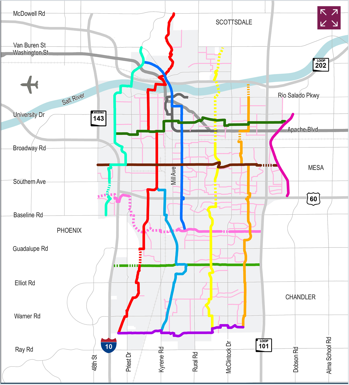
Tempe’s branded network of bikeways designed to help people safely, comfortably, and conveniently reach key destinations by bicycle, e-bike, scooter, or other micromobility options using streets with lower traffic volumes and featuring streetscape improvements.
A connected network of bikeways designed to help people safely and comfortably reach key destinations by bicycle, e-bike, scooter, or other micromobility options. The network primarily uses neighborhood streets with lower traffic volumes and may include improvements such as separated bike lanes, raised crossings, curb extensions, bridges, and landscaping to create a safer and more enjoyable riding experience.
A network of low-stress streets connecting users to BIKEiT routes and Multi-Use Paths. Secondary routes are designated by wayfinding signage or sharrows and are not intended to connect users directly to major destinations, but rather to provide first and last mile connections.
Frequent and reliable transit is essential to a balanced transportation system. Tempe is committed to making transit a reliable and convenient option for travel to/from, and throughout Tempe. The following recommendations are intended to improve service and make transit a more attractive option for everyday travel.
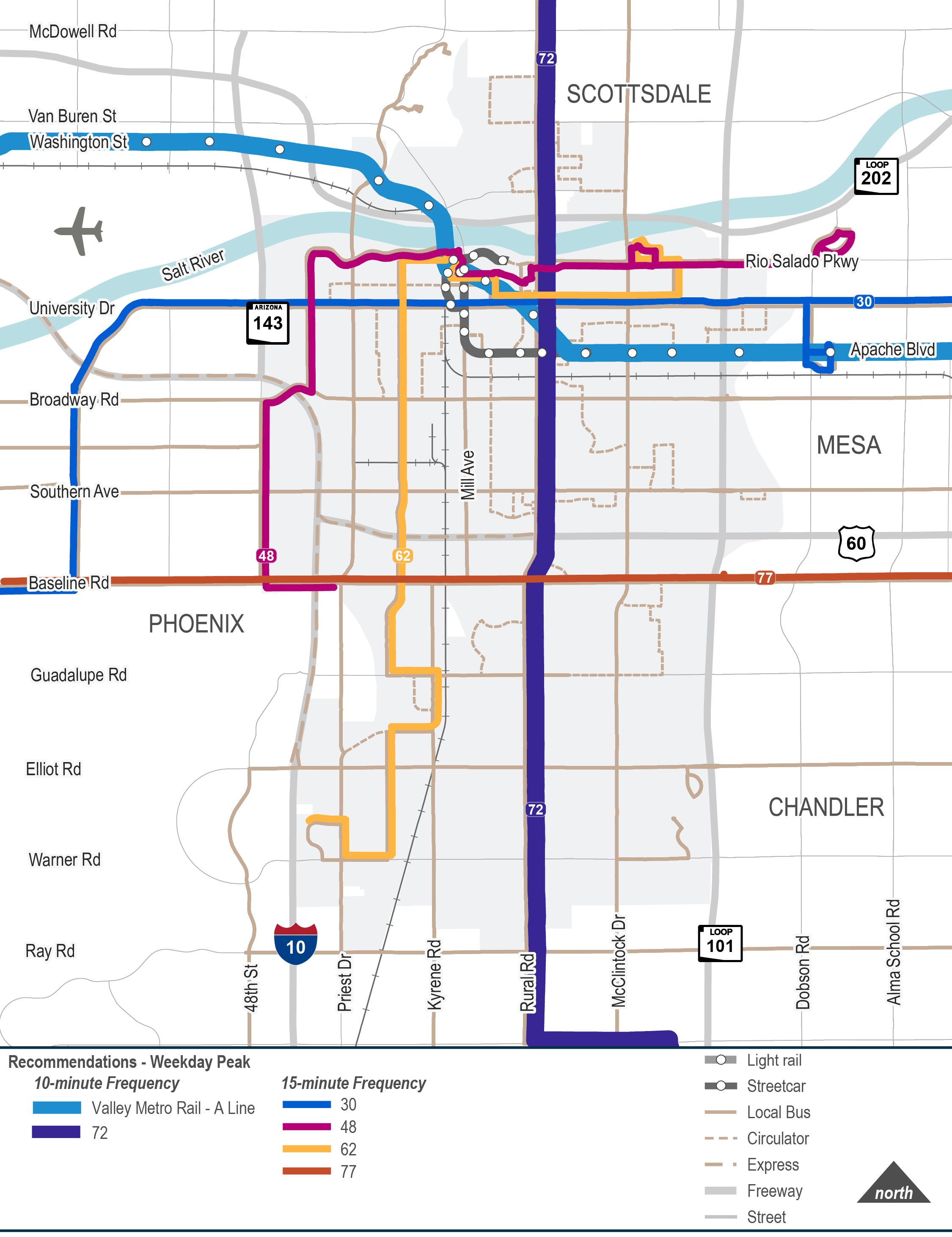
Implement 10-minute frequencies on Valley Metro A Line and Route 72, and 15-minute frequencies on Routes 30, 48, 62, and 77.
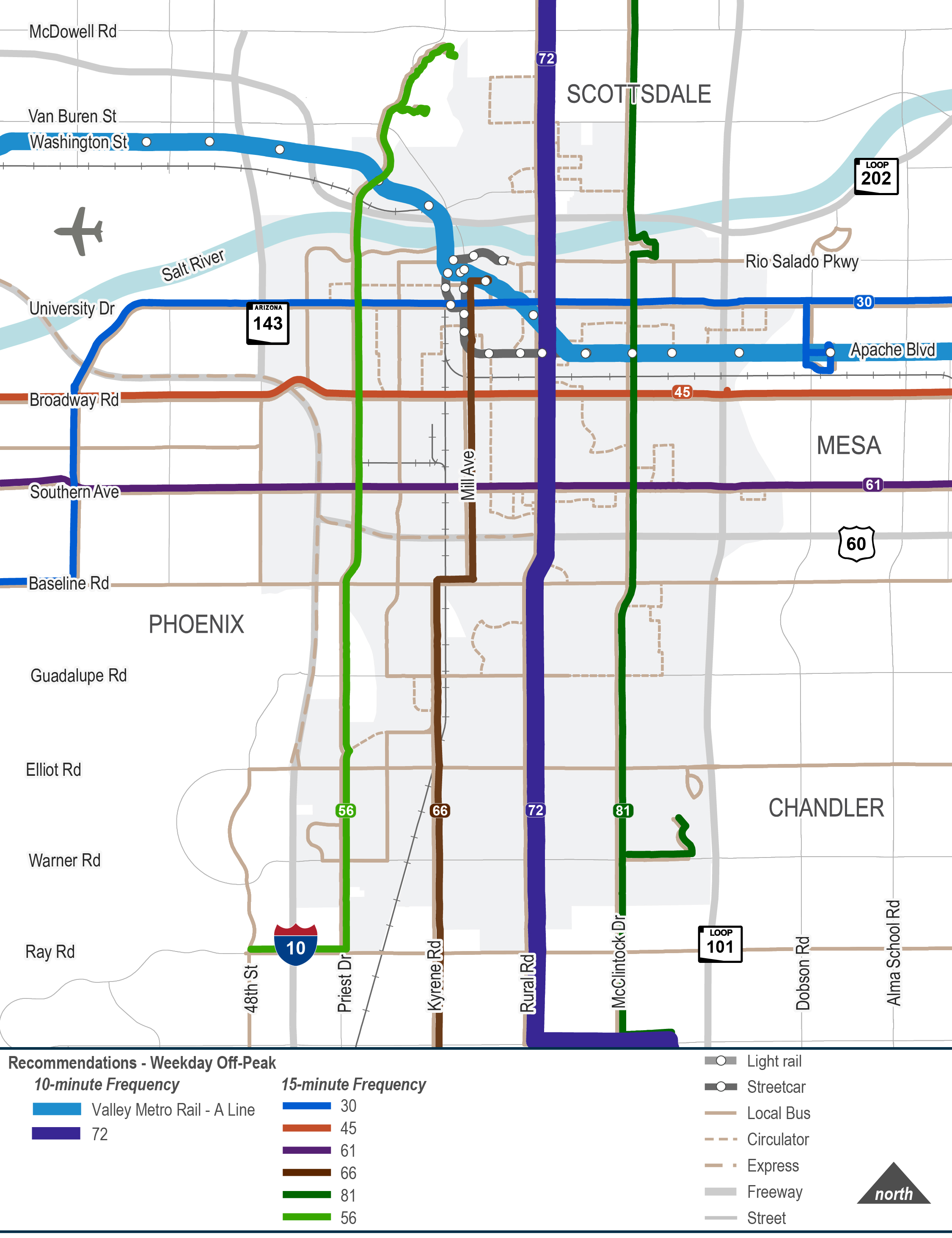
Implement 10-minute frequencies on Valley Metro A Line and Route 72, and 15-minute frequencies on Routes 30, 45, 56, 61, 66, and 81.
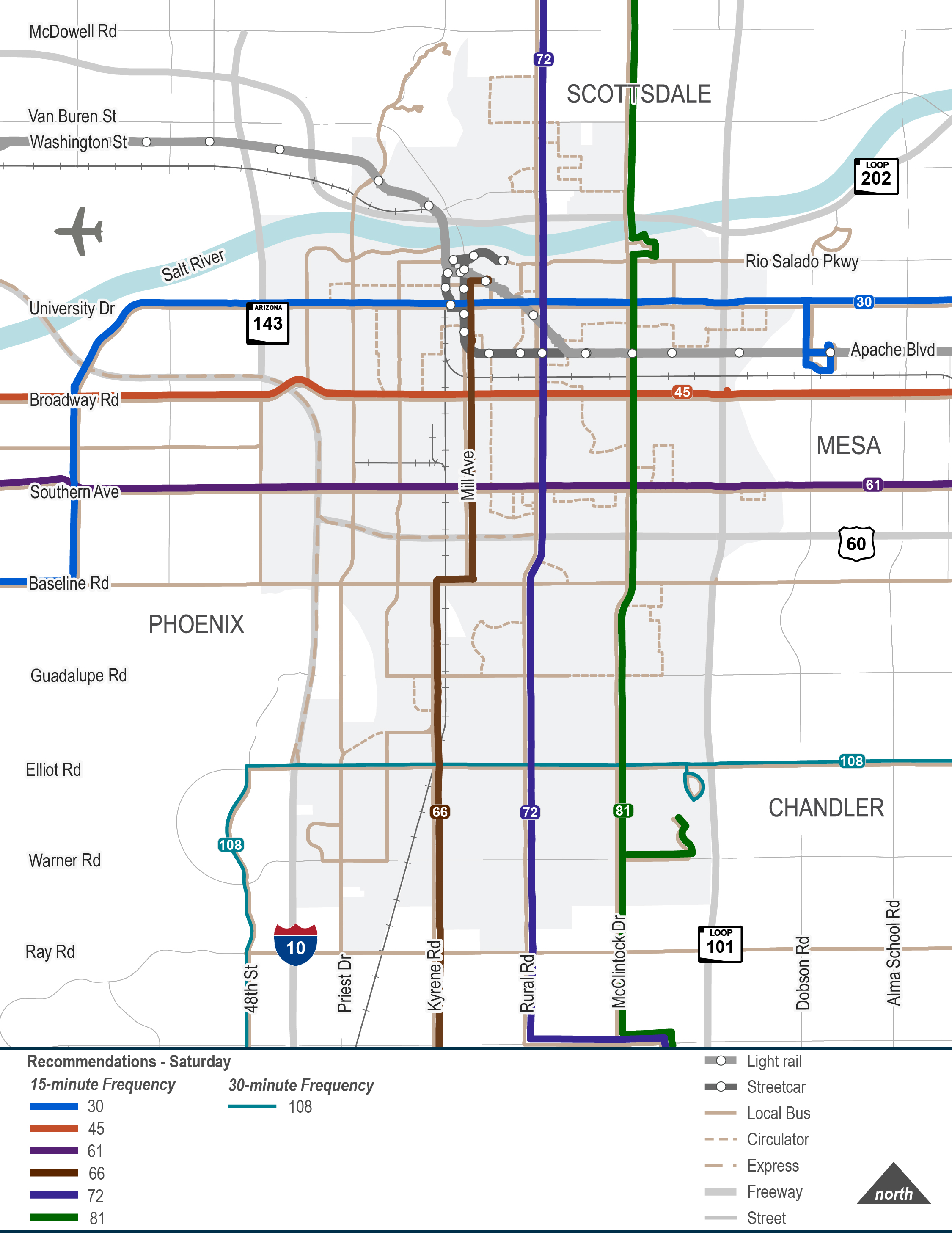
Implement 15-minute frequencies on Routes 30, 45, 61, 66, 72, and 81, and 30-minute frequencies on Route 108.
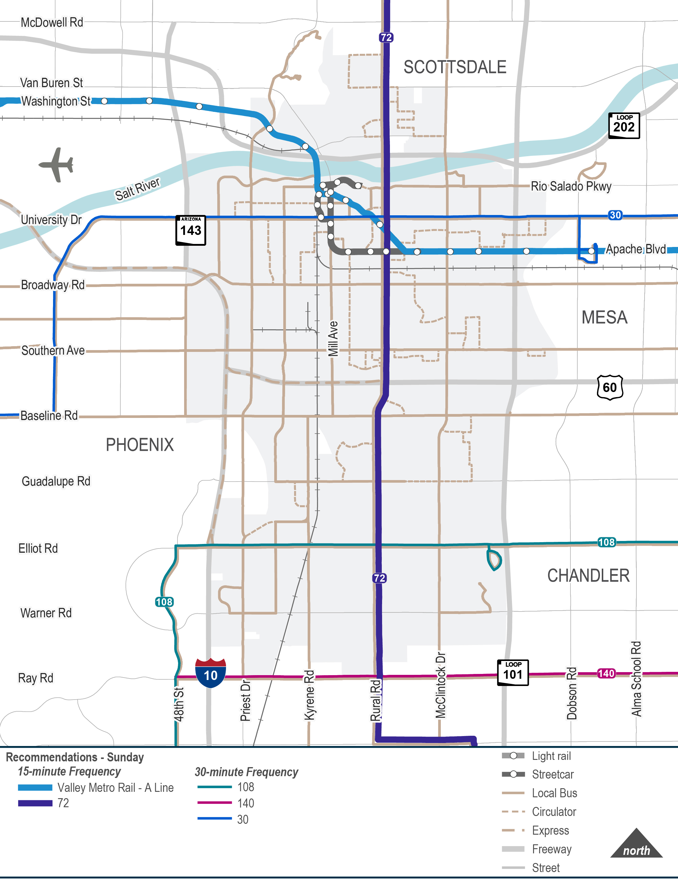
Implement 15-minute frequencies on Valley Metro A Line and Route 72, and 30-minute frequencies on Routes 30, 108, and 140.
Implement planned streetcar extensions and new BRT service. Consider new local bus service, new circulator service, consolidating express services, and passenger rail service.
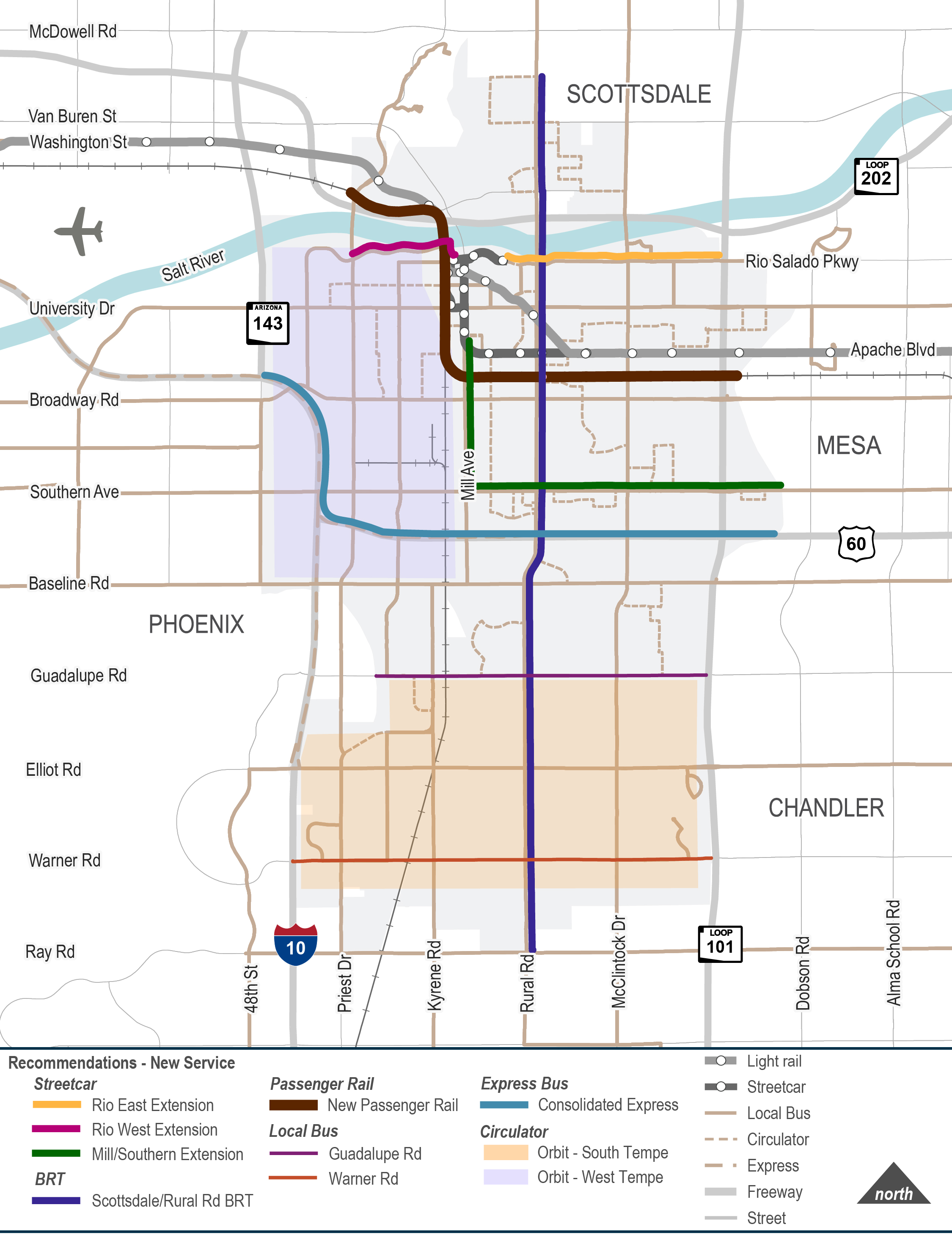

Supports operations during special events

Improves transit speed and reliability at highest boarding locations or areas of substandard on-time performance

Eliminates delays for transit riders and drivers caused by existing at-grade crossings

Improves transit speed and reliability by providing dedicated right-of-way for transit and can be leveraged by multiple routes where possible (e.g. streetcar and local/express bus on Rio Salado Pkwy)

Creates new inline transfer for US 60 express bus service
The Safety Action Plan and Active Transportation toolkits comprise a set of context-sensitive treatments that aim to manage speed, address common crash patterns, and improve safety, comfort, and connectivity along Tempe’s streets.
The Tempe Transportation Plan 2050 will include a variety of tools and strategies to improve mobility, accessibility, and safety throughout the City. The following section highlights these strategies. Click on each to see what they involve and where they can be used to improve safety, comfort, and connectivity for all users.
Click a category below to see an example of each set of strategies.
The projects identified through the planning process will be evaluated using both qualitative and quantitative methods to determine which best support the City’s transportation goals.
The project evaluation criteria are structured using seven criteria, identified through the planning and public outreach process. Earlier this year, during the Gaps and Need phase, over 300 responses were received to the survey question, “what matters most to you as we work towards project recommendations? During the February 25, 2026, public meeting additional public input was gathered on priorities. This information helped inform the weighting that will be applied to the different criteria when evaluating and prioritizing the projects.
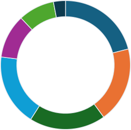
Enhance bike and/or pedestrian access
High Injury Network and safety enhancements
Improve or add new mode choices
Optimize corridor operations or reduce congestion
Planning-level estimates
Proximity to Equity Focus Areas
Property and access impacts